
Page 28 - Volume 15 Number 8
P. 28
u
Th
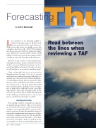
Read between the lines when reviewing a TAF
forecasting
by Scott C. Dennstaedt
Let’s assume you are planning a flight to Charlotte/Douglas Airport (KCLT) with an expected arrival in the early afternoon. While your coffee brews you shuffle over to the computer and notice the 1200 UTC terminal aerodrome forecast (TAF) for Charlotte simply says, FM091600 11012G18KT P6SM VCSH BKN070, which represents the prevailing weather conditions expected throughout the afternoon.
Showers in the vicinity of the terminal area with high cloud bases and good visibility below the deck do not seem all that threatening even for a pilot flying VFR into Charlotte. Would you believe me if I said this is a forecast for thunderstorms?
Okay, technically this is not a forecast for thunderstorms. Instead, it is one of several methods that a terminal forecaster will employ to quantify his or her uncertainty while attempting to cover the threat of deep, moist convection, better known to pilots as thunderstorms. This is certainly not obvious even to the most astute pilot until they understand the challenges meteorologists face to make such a difficult forecast, especially when there’s some risk of thunder later in the forecast period. Few pilots realize this and part of the challenge is learning what to expect and how to read between the lines of a TAF.
Quantifying Uncertainty
Forecasting weather is largely an exercise of quantifying uncertainty. That is, forecasters are ever rarely 100-percent certain of any particular weather event, especially when it comes to deep, moist convection. Despite the unrealistic desires of many pilots wanting miracles from meteorologists, convective weather is just not that predictable more than a few hours in the future – even then, forecasters often play a game of catch-up as the event unfolds. So, they use a probabilistic approach
26 • TWIN & TURBINE
AUGUST 2011
