
Page 16 - February 2016
P. 16
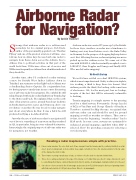
Airborne Radarfor Navigation?Strange that airborne radar is so seldom used nowadays for its original purpose. Bob Buck, author of the perennially-popular book “Weather Flying” and one of the greatest aviators of all time, once told me how in olden days he used airborne radar to navigate from Rome down across the Adriatic Sea to Athens. Due to political activities in that part of the world back then, VORs were often out of service and NDBs were frequently not where their identifier indicated they should be.Another time, after I’d conducted a radar training course for British West Indies Airlines down in Trinidad, my seatmate on the flight back to Miami was a deadheading Senior Captain. He congratulated me for having spent so much time in my course discussing use of airborne radar for navigation. He confided he still island-hopped with radar on his flights from Trinidad up to the States and back. He explained that, in the early days of his aviation career, ground-based nav facilities in South America were scarce and often inop, due to one revolution or another. He was forced to radar navigate just about everywhere he flew. It was a habit he still preferred in flying a Lockheed L1011.Just why the use of airborne radar for navigation fell out of favor is something of a mystery and has resulted in GA, in particular, being in a very vulnerable situation. Interestingly, the original purpose of airborne radar was for navigation, not weather.Airborne radar was created 75 years ago by the British. In those days, weather on radar was a hindrance to finding one’s way from Britain over to the Ruhr Valley in Germany for the purpose of dropping high explosives on it. But, following the war, radar navigating was never picked up in the civilian sector. We came out of the war with LORAN A, which eventually morphed over to LORAN C, then Doppler and Omega and finally GPS. Who needed radar mapping?We Need A BackupWe in GA have settled on a dual GPS/VOR system, which is most unprofessional. Safety is always in triplets; two working, a third to keep those two honest. Most airlines provide the third, the backup, with some form of electronics. GA, for the most part, has no backup, in spite of the fact that GPS is extremely vulnerable to hacking.Terrain mapping is a simple answer to the pressing need for a third system. Fortunately, George Lucchi of RCA at Van Nuys and George Church of Bendix at Teterboro, assisted by Skip Stevens, recognized that airborne radar can and should be used for ground mapping as well as weather avoidance. They saw to it that, from the beginning, “weather radars” had a MAP mode. In some cases, systems are optimized for enhanced ground mapping capability when MAP is selected. How? By providing a means for selecting a very short pulse.By Archie TrammelReading a radar map becomes simple with practice.A. Classic radar shadow. The echo that casts it has emerged from the terrain paint to positively Identify it as a tall object (you’re looking down on it at a rather steep angle, remember.) Since the shadow extends to the far edge of the display, the storm is talleB. Three towns or perhaps weak areas of rain, as evidenced by the lack of a shadow behind them.C. This echo is casting a shadow to the edge of the display, so it’s taller than you. Also it’s shape indicates it could be something other than a common thunderstorm. Best to widely circumnavigate downwind, which is to the eastD. Since these echoes are inside the 30 nm range and you are above FL290 they may be the tops of growing storms with that nasty bubble of CAT just above them. Wise to circumnavigate.14 • TWIN & TURBINEFEBRUARY 2016
