
Page 34 - Volume 15 Number 2
P. 34
series diagram of wind direction and wind speed and is derived from the radar’s base velocity (Doppler) data (see weather.cod.edu/analysis/ analysis.radar.html).
The VWP is not a point observation like a pilot report or radiosonde observation. It is a volumetric sample covering a region nearly 200 miles wide and depicts the general flow around the NWS radar site. As a result, important features may be smoothed over.
The VWP does not see clouds per se. It sees the movement of airborne particles called hydrometeors. Hydrometeors such as dust, birds, insects, cloud drops and precipitation scatter the radar beam. The VWP is unique in that the mere absence of data – plotted as “ND” for no data - can itself be an indicator. It suggests fewer scatterers, which implies dryer air – a common phenomenon behind cold fronts. But it is critical to understand a wind barb shown on this diagram does not imply the
presence of clouds necessarily, just the presence of scatterers (e.g., precipitation falling beneath a cloud deck).
Satellite
There are many kinds of satellite images to include visible, infrared and water vapor. Geostationary satellite images (such as GOES) are usually available at 15 minute intervals on ADDS (aviationweather.gov/adds/ satellite/). Each relies on a different set of wavelengths emanating from the cloud or vapor present in the atmosphere.
Visible imagery is useful to determine the extent of the cloud cover and higher resolution images may provide some clue as to the shape or texture of the tops. In other words, you may be able to tell the difference between a broken cumulus field of clouds versus an overcast stratus deck. During the winter you have to be careful since snow on the surface looks a lot like a cloud. In the end, the visible
satellite image alone can’t tell you much about the height of the cloud tops. That’s the job of the infrared satellite image.
A color-enhanced infrared satellite image will become your best friend to determine the tops of a cloud deck. Each color represents the temperature of the cloud top. Simply find the corresponding temperature using the color scale on the chart. Find a nearby RAOB or forecast sounding or analysis and correlate the temperature with an altitude. It’s that easy...well, almost.
Keep in mind that some of the colors you see on the image could represent the temperature of the surface, which could include snow on the ground. Also, low clouds and radiation fog will often have the same temperature as the surface. During the day, you can easily determine this by comparing the visible satellite image or surface observations (METARs) with the infrared image – remember that snow on the surface will look a lot like clouds on the visible satellite image. At night you’ll only have surface observations (METARs) for comparison purposes.
In some situations, a high cirrus deck may block the view of the cloud layer below, making it nearly impossible to determine the “tops” of the lower cloud deck simply using the infrared satellite image. This is where other products such as RAOBs and forecast soundings may help fill in the gaps.
Area Forecast (FA)
The area forecast (aviation weather.gov/products/fa/) has the advantage in that a meteorologist generates it. These forecasts will specifically identify the tops in reasonably small geographic locations for a period of up to 12 hours. For example, in this FA for North Dakota, the tops are forecast to be layered to 14,000 feet MSL for the western half, 12,000 feet for northeast North Dakota and 10,000 feet for southeast North Dakota.
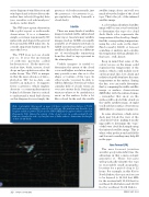
Echo top heights (discussed on page 33) have a vertical resolution of 5,000 feet and are not a reliable source for cloud tops. Shown here are the echo top heights valid at 2000 UTC from the NWS NEXRAD Doppler radar located in Bismarck, N.D. Given the extent of the cloud cover in south-central North Dakota, clearly the echo top heights are of little value to determine the height of this cloud deck.
32 • TWIN & TURBINE
FEBRUARY 2011
