
Page 13 - Twin and Turbine December 16
P. 13
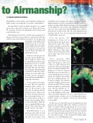
to Airmanship?
by Captain Guillermo Rubino
Nevertheless, we decided to steer well clear of them; we
didn’t want to get trapped by a terrible “CAT Bubble”.
Abeam BAQ I circled in white (in photo 6) a small green echo. Any idea of what it is? That’s the Route 90 causeway that ties Barranquilla with Cienaga and points farther east.
After flying 37 nm closer, another green appeared at the far end of the screen, right on our track at 240 nm, and the ones in the BAQ area seemed to be stronger and
extending to the right (both marked in red). To the left, abeam BAQ, there are other greens (white arrow). Those are a mixture of ground and clouds. That’s the Sierra de Santa Marta area.
Farther south, the picture became clearer. Shall we go left or right of course? Can we safely fly the gap between BAQ and echoes to its left? Although a left deviation through that gap may have been shorter, swinging right around CTG offered a clearer path so we went right. But, for ATC reasons, we had to wait until passing MORGI to begin the deviation.
As we progressed south, we saw that nice shadow, marked with a white “A”, cast by the storms to the left at about 120 nm. But the question now is, why we do not have ground clutter in the area marked with a “B”? To answer that you have to know some geography. There is only water there. What we see is somewhat hilly terrain ahead, then shoreline and finally water to the right.
With TILT still at -2o, it is perfectly clear that we had to avoid the green area to the left of our course. Just
remember, green means the chance I may encounter light turbulence is 100%, moderate between 5 and 20%, and severe almost NIL. But those chances are dependent on the highest color in the echo. Meaning, if there is any red, stay away from the ENTIRE echo, yellows and greens as well as the red! (So said thunderstorm scientist Jean T. Lee; do you remember him from the “Rough Rider” project?).
Note the green echo beginning at 25 nm over on the left and by the wind arrow down in the lower left corner. Careful scientific research has shown that lightning is most likely lurking in that green stratus cloud downwind of the storm. Stay away from it if at all possible.
After passing CTG
(Cartagena) we decided it was
time to get back on course and
a direct to LET (Leticia) was
requested. This is an interesting
picture in which I marked two
shadows; “C” and “D”. Can you
tell which one is produced by a
storm and which one not? Once
again, geography knowledge
gave me a helping hand. “D”
is pretty simple; the shadow
extends straight out from my
radar as a radial. That’s a radar
shadow behind a weak little
echo. But the shadow at “C”
shape is different. It’s slanted
across the display at odds to the
expected radial, therefore it’s not a radar shadow, it’s a terrain feature. In this case, it’s the Magdalena River Valley. Again, I recognize it from my knowledge of geography.
By the way, note that the beam is scanning the ground from 80 nm outward. That’s the “Parked” position for TILT. It’s where TILT should always be if you aren’t doing something else with it. Why? As mentioned earlier, with the ground being scanned from 80 nm outward, any echo that intrudes inside that 80 nm range has to be very tall, because of the downward-looking angle. Therefore, it’s a tall thunderstorm.
DECEMBER 2016
TWIN & TURBINE • 11
