Page 66 - Volume 15 Number 9
P. 66
ON FINAL by David Miller
Balls in the Air
Ihave never been able to juggle. Every time I tossed the second ball in the air, I had no idea where either of them was going.
In my Citation Mustang, I am somewhat better at managing multiple tasks. An example this spring started off with an urgent call to take a family member to visit her hospitalized mother in Louisiana. The stress from the urgency of the request was ball number one. The day of the flight, I needed to be in Dallas for an evening fundraiser. Ball number two. And then there was the weather. A line of severe thunderstorms covered the entire Southeast causing one tornado death, 11 injuries, and damaging 100 homes in Rayne, La., just 90 miles west of my destination, Hammond, La. Ball number three.
Dawn at my home base in Dallas saw frontal passage with wind but little associated weather. Hammond, though, is 1.3 hours east in the Mustang, and as the frontal boundary moved eastward, a line of thunderstorms with tops to fL450 soon developed. Contiguous SIGMETs ran from San Antonio to Little Rock. No going over or around this one. I would simply have to wait it out. Putting my passenger on an airline was an option that would add several hours to the ordeal. I wasn’t sure even the pros would make it into New Orleans. No rental cars either due to Mardi Gras weekend. I began the “weather watch” we all do:
1 Check the current weather.
2 Is the forecast accurate? Has it been amended?
3 Calculate the latest I could depart and land behind the severe weather.
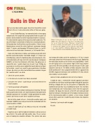
With 5,000-plus hours in his logbook, David Miller has been flying for business and pleasure for more than 40 years. Having owned and flown a variety aircraft types, from turboprops to midsize jets, Miller, along with his wife Patty, now own and fly a Citation Mustang. You can contact David at davidmiller1@sbcglobal.net.
real energy with winds out of the southwest at 115 kts. It would later dump almost two feet of snow on the East Coast. Monitoring the destination weather on the G1000 and using NEXRAD, I knew we were going to be at the western edge of the heavy weather upon arrival. We went solid IMC in the descent out of fL240. Light turbulence and no ice. The AWOS at kHDC indicated a wind shift to the northeast of 10 kts. I programmed the GPS 31 approach into the MfD. Approach minimums were an MDA of 417 AGL and one mile visibility. Current weather:
06003 kT 3SM +RA BkN 005 OVC 007 LTG E THRU S
It might be close. I reviewed the missed approach procedure and talked my non-flying co-pilot/passenger through the approach briefing as though she was my sim partner at flightSafety. She wondered out loud why I was mumbling to myself. Very few folks were flying today and I had personal service from the approach controller. We began the descent at the fAf and continued right down to minimums. We broke out 50 feet above minimums to one of the most pleasing sights in aviation: a clear runway straight ahead. After a quick turn, I made the party in Dallas, too. Airplanes are awesome.
Someday, I just may be able to juggle. fly safe.
4
Text my passenger with updates.
This process went on almost continuously all morning. The front built up speed and severity as it moved eastward. Non-pilot family members (pronounced “my mother”) kindly questioned my sanity. So did I, but I knew at some time it would be safe to go.
We met at the airport at 2 p.m., checked the weather again, and launched. SIGMETs were now just east of the destination with the current weather at kHDC:
12003 kT 5SM TSRA SCT 022 BkN 033 OVC 045 19/18 RMk LTG DSNT ALQS
Departure was in light to moderate turbulence and we were on top at fL330. The winds aloft told another story. The air carriers were all looking for smoother altitudes. This system had some
64 • TWIN & TURBINE SEPTEMBER 2011


