
Page 22 - Volume 16 Number 8
P. 22
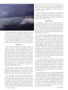
With a good airplane, carrying a surfeit of fuel, one can work around a storm line and perhaps make an attempt at an approach with plenty of options. Never proceed unless you have an “out” toward which you can turn in an untenable situation. Never allow yourself to get boxed in by building storms. To be sure, ATC’s cooperation may be difficult to secure, but when push comes to shove, the pilot’s authority must be exercised.Use The ToolsOnce the trip is planned and given a chance of success, the tools of the trade are applied to the task of outsmarting the convective weather while en route. Never forget that storms operate dynamically; what you saw before departure soon becomes history, so you must keep abreast of developments. That means watching the path of movement on radar, and noting a tendency for a line of storms to bow outward or develop a hook, both bad signs for that sector. As soon as you can determine the direction of movement, start updating your alternatives. Unless the movement is slow, don’t try to get in ahead of the storm or, if you do attempt the arrival, keep a clear-air alternative at your elbow. Never commit to an approach that MUST be made.Check surface weather conditions at other airports, those lying in the storm’s path before it arrives at your destination; they can alert you to outflow winds or other phenomena. Only a timely report is of value – if it’s a stale hourly observation, it’s no better than a history lesson.Your best input is from your own eyeballs, working in concert with what you’ve heard from a briefer, seen on your display and expected from traffic activity ahead of you. Stay in VMC if at all possible, so you can work around the towers and avoid the overhangs where hail can fall. Using your experience, you’ll know what a mean- looking cloud holds inside, and if you can get a look at it, you won’t go there. The embedded cell is always a threat20 • TWIN & TURBINEwhen you must fly in cloud, so adjust tilt and check a profile view to stay current on the radar returns ahead. Always remember that radar shows precipitation, not turbulence. Heavy rainfall rates are only one indicator of areas to avoid.Our friend and former freight pilot Doug Rozendaal believes in using the predictive capability of a Stormscope. Electrical activity is often a precursor to rainfall, showing where the development is taking place and the ride is already rough.If All Else Fails...It’s inspiring to read accounts of the early days of flying the line, when men of iron plied the skies and one flew in the weather, not over it or around it. Captains of the old unpressurized piston airliners simply had to choose a “soft spot” and bore through, hoping they had heard correctly of clearing weather through their static- filled headsets. Often out of fuel and luck, they had no alternative but to press on.Those who brag of penetrating a thunderstorm may have only been blessed with good fortune, in that they missed the core of the storm, or picked one that was in its dissipating stage, or encountered a less-severe specimen. Even so, the ride will be memorable, from what I’ve heard and read. All hands on board should be secured tightly at their stations, loose objects stowed, cockpit lighting selected full-bright and engine ignition turned on. Turbulent air penetration speed is obviously a starting point; don’t expect that it will be held with any degree of precision. You may want to restrict the autopilot to flight director mode; hand flying is the better choice when the going gets tough. Inform air traffic control that you will be requiring a block of altitude; most likely, your bit of airspace is uncongested. Only the hardy and the half-witted are out here today.I once flew through the edge of a line with an experienced captain in a medium twin and noticed that his hand was on the landing gear handle as we entered the area, slowed down to Vlo. His reason was that, if he felt the initial updraft that meant we were entering the storm’s upward surge, he would drop the gear to stabilize the aircraft and add drag. At his command, I would retract it when we flew into a downdraft or cleared the storm.During the passage, one can expect torrential rain, hail, rapid icing, extreme turbulence, blinding lightning and perhaps St. Elmo’s fire or lightning strikes. The quickest way out is straight through, so the primary focus should be on heading control, with maintaining a level attitude given priority over sticking to an assigned altitude. Lessen the stress on the airframe by allowing the airplane to rise and descend. Once the ride smooths out, check for electronic or control damage and see to the cabin, where some tidying up may be needed.AUGUST 2012
