
Page 16 - Twin and Turbine June 2017
P. 16
You’ll find what happed to him incredible, so best to quote the NTSB report:
According to the pilot, the flight departed FLL, climbed to flight level 270 (FL270), and intercepted “J20” toward the Orlando Executive Airport (ORL), without incident. Air traffic control (ATC) advised the pilot to deviate to the west around ORL, if necessary due to weather.
Approximately 30 nautical miles from ORL, the pilot requested a direct clearance to the Craig VORTAC (Jacksonville), which was denied by ATC. At 10 miles from ORL, the airplane was cruising in visual flight rules (VFR) conditions, when the pilot observed a 10-mile wide opening between a large thunderstorm cell and a smaller cumulonimbus (CB) buildup that was developing just to the southwest of the large cell. As the airplane approached the gap between the two cells, the pilot noticed that the CB was developing faster than he had anticipated, with tops that had grown from about FL270, to about FL290. The pilot utilized a Bendix/King RDS-82VP onboard weather radar, which was
depicting only light precipitation, while the large thunderstorm cell northeast of the airplane was depicting extreme precipitation. The pilot navigated closer to the (smaller) CB to stay clear of the large thunderstorm cell. As the airplane entered the northeast side of the CB, it encountered light to moderate turbulence, which was followed by an extreme downdraft.
The pilot further stated: “The altimeter began to unwind rapidly and I tried to correct the altitude change with up elevator pressure, as well as additional power. This corrected the situation momentarily, but the downdraft continued and I feared that I would compromise the elevators if I continued to apply the pressure necessary to maintain altitude. I relaxed the pressure and pulled the torque on both engines to idle, to try to induce drag to slow the descent. At this point in time we were losing approximately 4,000 to 5,000 feet-per-minute and the aircraft began to roll left.
“My memory from that moment forward is blurred, but I’m certain that the aircraft entered a downward spiral to the left with an attitude greater than 100 degrees left, and a near vertical descent. The artificial horizon tumbled at that point. I thought that we would not recover. The AH righted itself briefly and tumbled again. The AH righted itself one more time and l reacted immediately with right aileron and rudder and the aircraft rolled level.
“As it began to roll level, I began to apply up elevator and power in an attempt to arrest the decent. The airspeed began to drop and the aircraft remained level.”
The airplane was recovered at an altitude of about 14,500 feet. Shortly thereafter, the airplane exited the clouds. The pilot noticed what appeared to be wrinkles in the upper skin of the left wing. He further noticed that the right elevator outboard hinge was separated from the stabilizer and that both the elevator and stabilizer were damaged. The right elevator was bent downward approximately 30 degrees, about two-thirds from the root.
The pilot elected to divert to the Brunswick Golden lsles Airport, Brunswick, Georgia, where the airplane landed without incident.
This pilot was educated expensively, near fatally that the hazards of a thunderstorm are not necessary in the colors depicted on airborne radar; they may be encountered out where it is now black due to a rapid growth and change.
Things an IFR Pilot Must Know
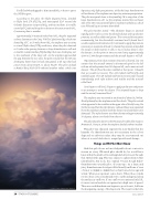
Had this pilot been as knowledgeable about convective storms as every IFR-rated pilot should be, he would have known that the small cell would explode before he got through that 10-milewide gap. This was classic to a phenomenon first identified by Jim Cook, the original “Project Rough Rider” thunderstorm research pilot, 45 years ago. As a large and juicy thunderstorm develops it lifts literally millions of tons of water to 30,000 to 40,000 feet on hurricane-force upward winds. What goes up must come down. When those winds reverse they come screaming down to earth and spread along the surface as outflows. If one outflow encounters a little lift, it turns vertical and shoots upward at a high rate of speed. Then a second thunderstorm begins to grow from it, fed from the dissipating energy of the big storm. The result is the little
PHOTO: PAUL BOWEN PHOTOGRAPHY
14 • TWIN & TURBINE
June 2017
